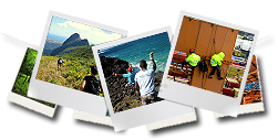
Hiking / Trekking / Mountaineering
- Guided by a professional guide.
-
Pictures will be taken during the trip and offered.
-
Food & beverages included (conditions apply).
Technical Level = ![]() Physical Level =
Physical Level = ![]() Half Day =
Half Day =![]() Full Day =
Full Day =![]() 1 = Easy / 2 = Medium / 3 = Hard
1 = Easy / 2 = Medium / 3 = Hard
| ACTIVITIES | MIN & MAX NO. OF CLIENTS | LEVEL & DURATION | DETAILS | MEETING POINT DEPARTURE |
MEETING POINT ARIVAL |
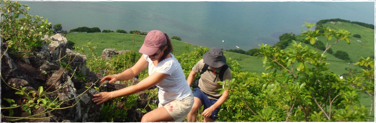
| "Le Pouce" mountain 812 m |
2 to 12 | The 3rd highest mountain of the island. A pleasant hike, offering beautiful views on the whole island. Have a view on the busy city of Port Louis while enjoying the fresh air of the mountain. | 9 a.m. or 1 p.m. Parking Bagatelle shopping park in front of Food lovers market (follow us with your vehicle to the starting point or pick up the guide) |
1 p.m. or 5 p.m. Parking Bagatelle shopping park in front of Food lovers market |
|
| "Lion" mountain 480 m |
2 to 12 | Start at sea level & climb on the south south-east face. During the climbing do have a look behind on the magnificent largest bay of the island, "Vieux Grand Port" bay; its history and the multiple other islands. Mix of trekking and climbing. Our way down is smoother under the rich endemic and tropical forest canopy. | 9 a.m. or 1 p.m. Dutch Museum Vieux Grand Port |
1 p.m. or 5 p.m Citizen Advice Bureau Bois des Amourettes (those who left their cars at the Dutch Museum will need to take the bus to go back to same). |
|
| "Piton de la Petite Rivière Noire" mountain 828 m |
2 to 12 | The highest summit on the island and quite the easiest. The real climb is the last 15 minutes before summit. View on the south south-west sea, plains and mountains as well as the amazing cliff separating the south-west plains and the centre of the island. | 9 a.m. or 1 p.m. Viewpoint Black River Gorges |
1 p.m. or 5 p.m. Viewpoint Black River Gorges |
|
| Macchabée forest |
2 to 12 | Enjoyable hike at altitude 650 metres. Walk at ease along flat and large tracks, mixed with pathways. Along the way, small openings throughout the dense forest of Chinese guava trees give way to magnificent viewpoints on the Gorges, the waterfalls and the west south-west coast. It is the perfect location to meet the indigenous bird of Mauritius (Echo Parakeet & Pink Pigeon). The different tracks/circuits can be merged with some more challenging or more technical paths; up/down paths and river crossing by Mare-aux-Joncs waterfall. |
9 a.m. Junction Pétrin/Grand Bassin |
12:30 a.m. Junction Pétrin/Grand Bassin |
|
| Macchabée forest (Petrin-Mare Longue track with lunch at Domaine de l'Arbre du Voyageur) | 2 to 12 | Consider an additional cost for the lunch. Possibility of having a shower and lunch at le Domaine after the hike. | 9 a.m. Junction Pétrin/Grand Bassin or Domaine de l'arbre du Voyageur (then follow us with your vehicle to the starting point) |
1 p.m. Domaine de l'arbre du Voyageur |
|
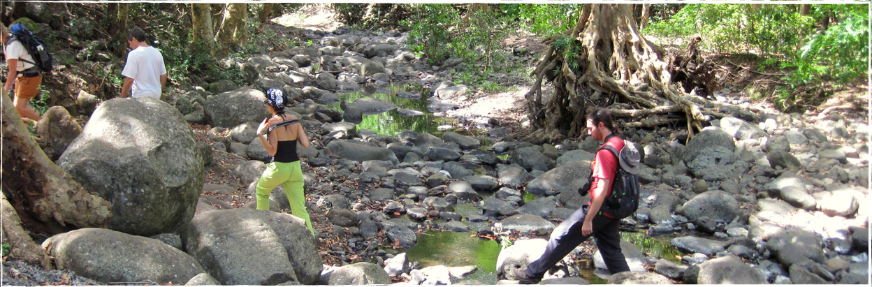
| Black River Gorges National Park (Petrin to Black River) | 2 to 12 | Choosing to hike in the Gorges brings you under a rare but magnificent tropical forest canopy. Being in the south west, known as the driest and hottest region of the island, you will surely be pleased to swim in the "Black river gorges" river. | 9 a.m. Junction Pétrin/Grand Bassin |
1 p.m. Black River Gorges National Park Parking |
|
| Macchabée forest via Mare-aux-Joncs followed by the Black River Gorges National Park |
2 to 12 | Enjoyable hike at altitude 650 metres. Walk at ease along flat and large tracks, mixed with pathways. Along the way, small openings throughout the dense forest of Chinese guava trees give way to magnificent viewpoints on the Gorges, the waterfalls and the west south-west coast. It is the perfect location to meet the indigenous bird of Mauritius (Echo Parakeet & Pink Pigeon). The Mare-aux-Joncs junction is a single steep track that goes above a waterfall. Choosing to continue in the Gorges brings you under a rare but magnificent tropical forest canopy. Being in the south west, known as the driest and hottest region of the island, you will surely be pleased to swim in the "Black river gorges" river. |
9 a.m. Junction Pétrin/Grand Bassin | 3 p.m. BlackRiver Gorges National Park Parking |
|
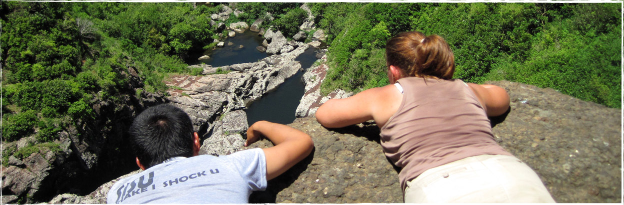
| Tamarin Falls | 2 to 12 | Starting from the Tamarin Falls viewpoint, a 40 minutes hike brings you to the hydro-electric power station found at the bottom of the canyon. From there 5 hours hike all the way up along a minimum of 7 waterfalls. You can swim in the ponds. | 9 a.m. Henrietta Bus Terminal (100m from Tamarin Falls) | 3 p.m. Henrietta Bus Terminal | |
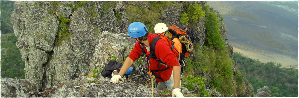
| Pieter Both 823m (Trekking with harnesses, helmets and ropes.) | 2 to 12 | Second highest and most difficult summit on the island. "Pieter Both" mountain is famous for the ball shaped rock standing on its top. Mission of the day is to stand on that particular rock. Rope, harness and helmet will be used for that trek. 360° view on Mauritius and the northern islands. The way down may be either by mean of 2 rappels of 70 meters each or by the same way up. If you manage to be on the rock, no way to trek back, the rappel awaits. |
7 a.m. Mont Désert Alma round about (follow us with your vehicle to the starting point) |
4 p.m. Mont Désert Alma round about |
![]()
![]()
FOR ANY SPECIAL REQUEST (Exclusivity, group of more than 12, information on other sites, etc...),
do not hesitate to ask us.
Bring
![]() Towel & swimming suits
Towel & swimming suits
![]() Sunscreen
Sunscreen
![]() Mosquito repellent
Mosquito repellent
![]() Cap and sunglasses
Cap and sunglasses
![]() Any medications in 2 sets (one on client and one with the guide)
Any medications in 2 sets (one on client and one with the guide)
![]() For those wearing spectacles think of taking straps to hold them
For those wearing spectacles think of taking straps to hold them
![]() A light wind breaker and rain jacket
A light wind breaker and rain jacket
![]() Sport shoes/hiking shoes
Sport shoes/hiking shoes
![]() Clothes in which you feel at ease for walking, that might get dirty
Clothes in which you feel at ease for walking, that might get dirty
![]() Back pack. (Also available on demand - limited stock)
Back pack. (Also available on demand - limited stock)
Restrictions
Otelair Ltée reserves the right to cancel any activities considering weather conditions and /or the number of participants.
(230) 5251 6680
Latest News & Events
Otelair web site launching [ Read More ]
Rebranding Otelair [ Read More ]
#MyMauritius experience with Otelair [ Read More ]
#MyMauritius Ebook [ Read More ]
Join us on


